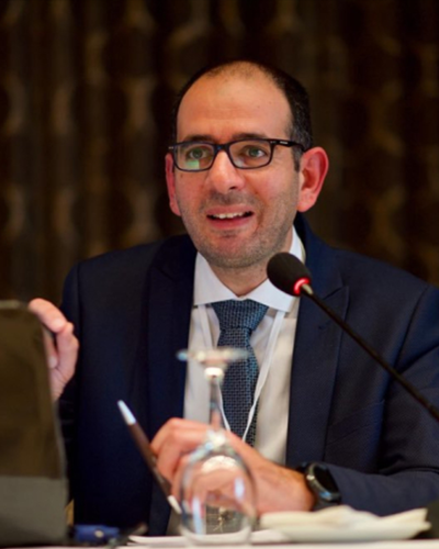
George Mitri.png picture
Full Name
Mitri, George
Title
Professor
Position
Director, Land and Natural Resources Program
Category
Full time faculty


Other emails
 
UOB Author ID
A1611
 
Campus
Koura
 
UOB join date
05-10-2009
 
Office
Saliba, Third Floor
 
Phone Extension
3944
 

Results 21-40 of 62 (Search time: 0.0 seconds).

Issue DateTitleAuthor(s)
212010Mapping postfire vegetation recovery using EO-1 hyperion imageryMitri, George ; Gitas, Ioannis Z.
222010Mapping post-fire forest regeneration and vegetation recovery with the combined use of very high spatial resolution and hyperspectral satellite imageryMitri, George ; Gitas, Ioannis Z.
232017Mapping plant abundance and phyto-sociability using sentinel - 2 satellite imageryMitri, George ; Beshara, Joseph; Nehme, Maya; Nassar, Abdo
242016Mapping greenhouse gas emissions and removals from the land use, land use change, and forestry sector at the local levelMitri, George ; Karam, J.
252017Mapping burned areas from time series of Landsat imagery for estimating greenhouse gas emissions at the National levelMitri, George ; Nader, Manal ; Kai, Lea
262014Managing wildfire risk in Lebanon: an increasing risk in a changing worldMitri, George 
72016Lebanon's national blueprint for a sustainable forest biomass: promoting renewable energy and forest stewardshipMitri, George 
82015Land use and land degradation in times of violent conflictMitri, George ; Issa, Sahar
92018Land degradation mapping and assessment using object-based image analysisMitri, George ; Nasrallah, Georgy; Masri, Noura; Choueiter, Dominique
102022Investigating the potential impact of climatic conditions on fire occurrence in LebanonMitri, George ; Gebrael, Karen 
112020Investigating the performance of sentinel-2A and Landsat 8 imagery in mapping shoreline changesMitri, George ; Nader, Manal ; Abou Dagher, Manale ; Gebrael, Karen 
122018Investigating the evolution of Lebanese shoreline using object-based image classificationMitri, George ; Nader, Manal ; Bou Dagher, Manale
132014Investigating temporal and spatial variability of wildfire potential with the use of object-based image analysis of downscaled global climate modelsMitri, George ; Jazi, Mireille; McWethy, David
1421-Sep-2023Geoinformation applications for monitoring protected areas in LebanonMitri, George ; Bechara, Joseph; Stephan, Jean; Naimeh, Anna; Mckenna, Maher; Choueiter, Dominique
152011Fuel type mapping in the mediterranean region of north Lebanon using object-based image analysis of ASTER imageryMitri, George ; Nader, Manal ; Salloum, Liliane
162016Forest inventory and management plans of Bkessine and Andket forests in LebanonMitri, George 
172012Forest fuel type mapping in LebanonMitri, George ; Salloum, Liliane; Nader, Manal 
182014Forest fire detection sensor nodeSakr, George E; Ajour, Rafik; Khaddaj, Areej; Saab, Bahaa; Salman, Alaa; Helala, Ola; Elhajj, Imad H.; Mitri, George 
192018FireLab: an operational toll for improved monitoring and management of fire risk in Lebanon.Mitri, George ; Nader, Manal 
202014Evaluating fire risk associated with repetetive armed conflictsMitri, George ; Nader, Manal ; Van Der Molen, Irna; Lovett, Jon C.